
Map track link
April 26,2017
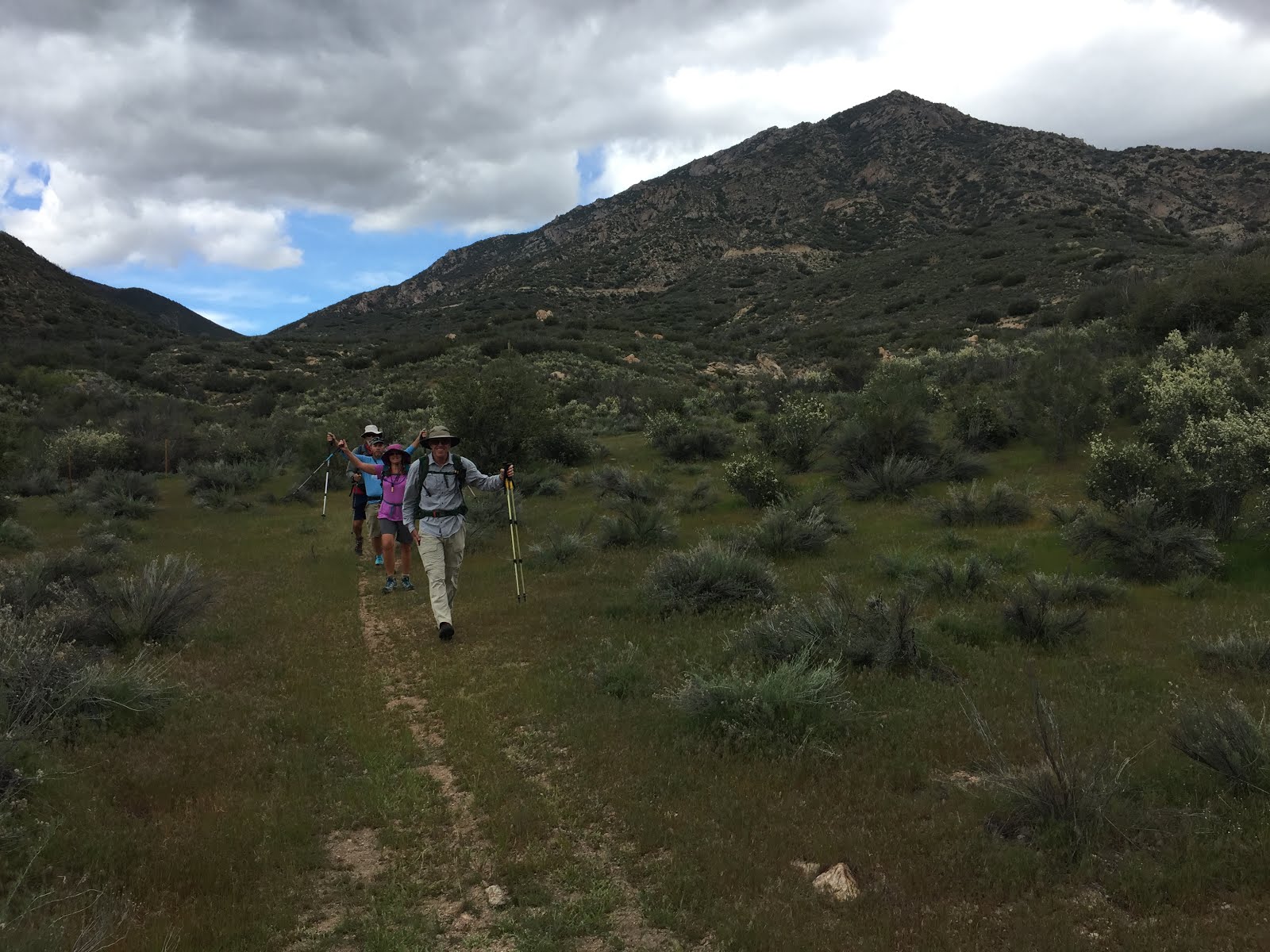
We did a car shuttle with friends, Brian, Shawn, and Gina repeating the North Fork Kern River hike we did get a few weeks ago and extending it with a connector trail to the Rincon trail and then heading out on the Packsaddle Cave trail.
April 26,2017
We did a car shuttle with friends, Brian, Shawn, and Gina repeating the North Fork Kern River hike we did get a few weeks ago and extending it with a connector trail to the Rincon trail and then heading out on the Packsaddle Cave trail.
 |
| common madia |


The first thing we noticed was that the North Fork Kern was
higher than our previous visit. The
water was also filled with sediment and had a malevolent look to it. We were all very careful with our footing as
falling in would not have been a good thing.


We had lunch at the end of the river trail and then headed
up the connector trail. The connector
was fabulous, filled with small waterfalls and a bonus mine tunnel.


 |
| larkspur |


The Rincon trail provided us with views north of the snow
covered mountains and more, albeit, distant waterfalls. It looked like it would be a great area to
explore further, and is now on the ever expanding list.


 |
We crossed Sherman Pass Road on our journey south and had
several black-chinned sparrows on territory.
It was a treat to listen to their accelerating ping pong ball song.
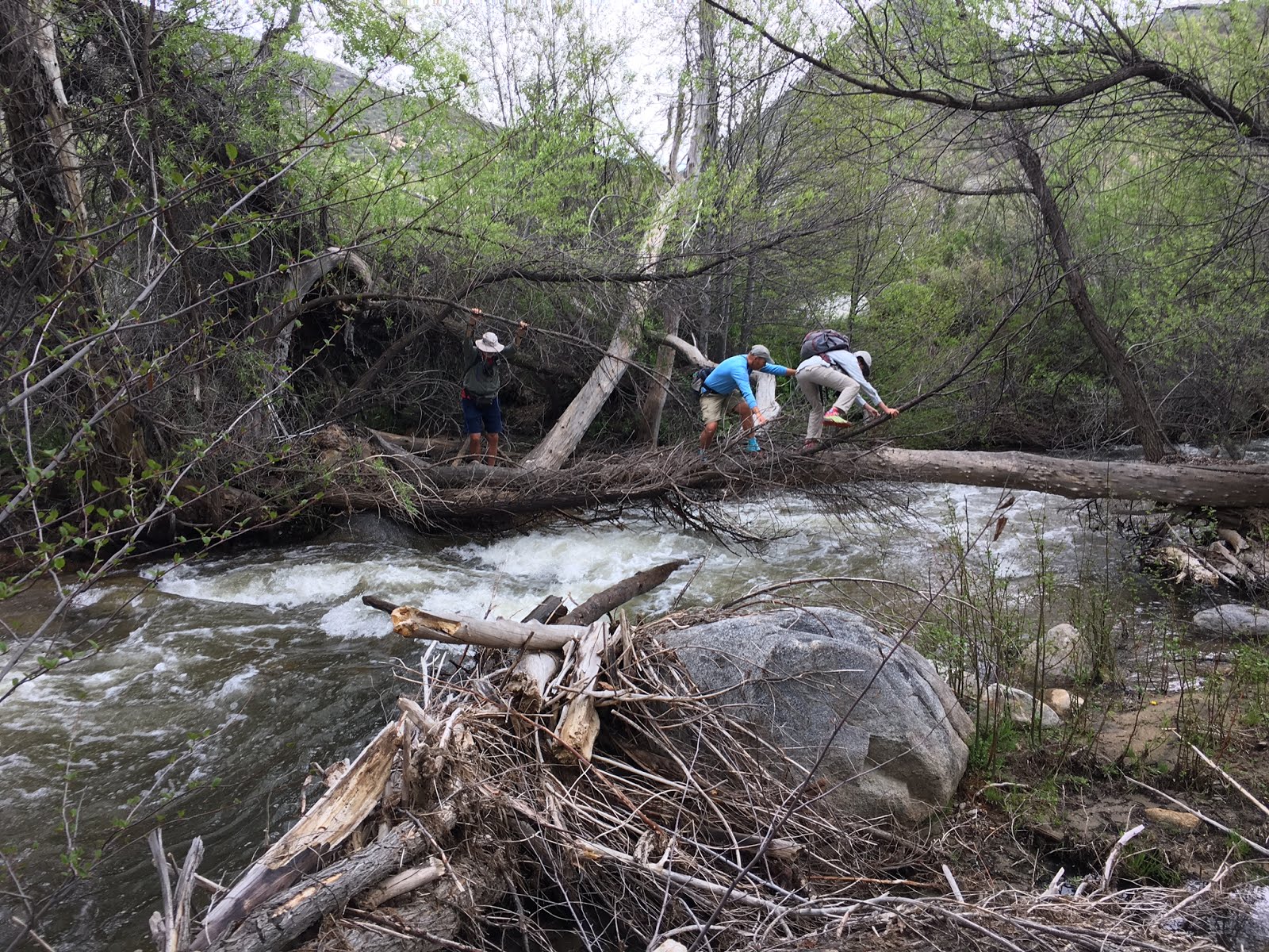
And then we hit Brush Creek.
It was not a happy burbling creek, it was a raging river. Brian found a log and he headed across to
check it out. It was doable, so Bob and
Susan followed. Gina and Shawn decided
to do less mileage and head back to the car.
 |
| the trail crosses the creek here in low water |


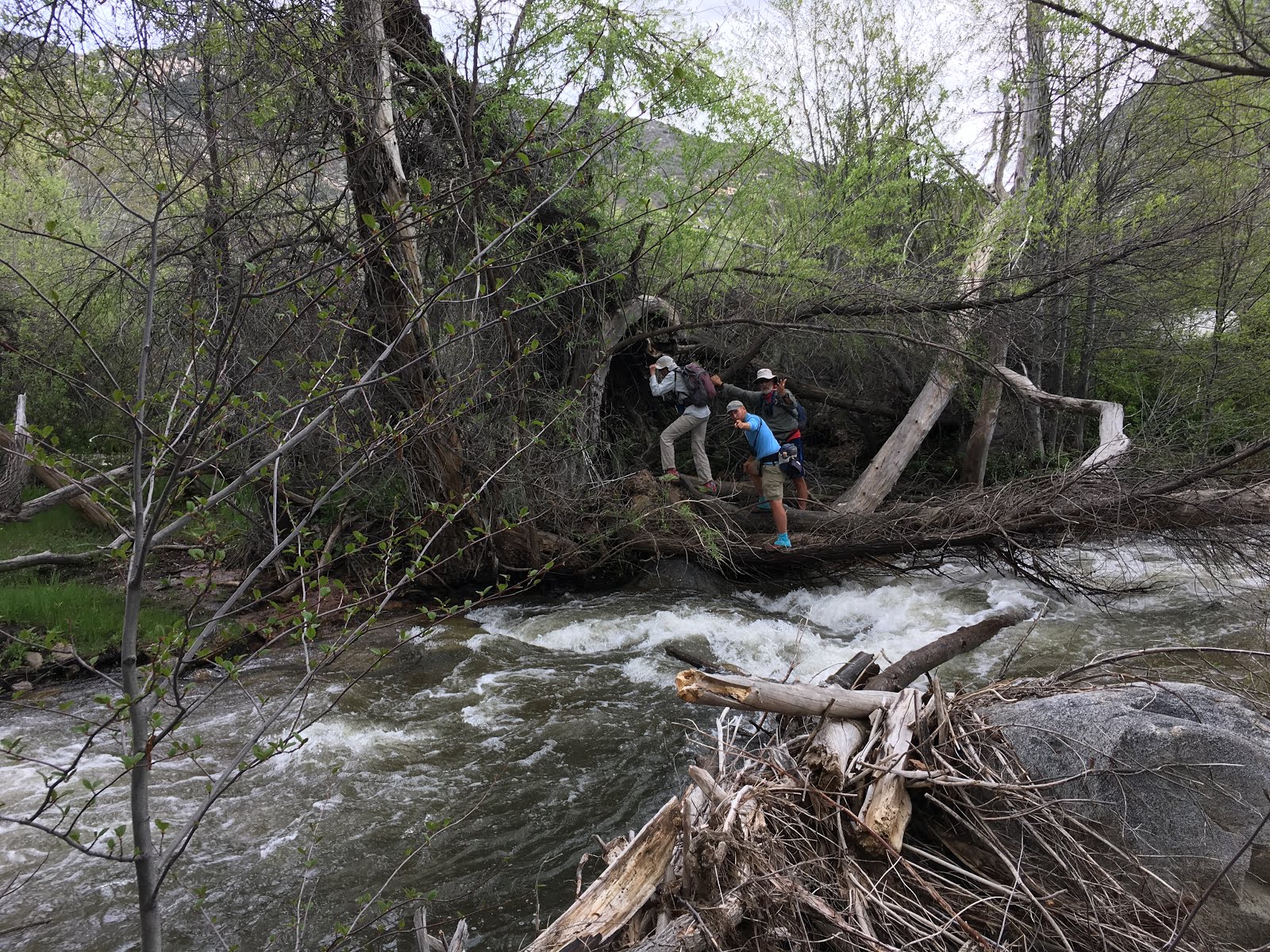 |
| River crossing photos by Shawn Peters |
As the rest of the Rincon trail from there wasn’t much to look at, leaving a car at Sherman Pass will probably be the way to go in the future. Bob did point out that this would mean missing Packsaddle Cave, so maybe it is a tossup on where to come out. Ok, so the Packsaddle connector trail was pretty too.

 |
| Indian Pink |


Susan, I've heard you don't enjoy river crossings that much. You are such a trooper to do that crossing. Good Gawd.
ReplyDelete