Wednesday, September 30, 2015

Fall Colors and Big Mountains along Bishop Creek

Two hikes were planned this past weekend included seeing the start of the fall colors season at the highest elevations in two of Bishop Creeks major basins. Friday we went up the middle fork to its farthest reaches at Echo Lake, and Sunday was a jaunt to North and Grass Lakes on the north fork.


Echo Lake  


18 miles

Map track

Trail tunnel through color
The shorter fall days call for an early start from the Lake Sabrina trailhead for what we know will be a long day, so we are off by 7:30. The aspens above 9,000 feet are peaking now and the entire lake basin is alive with patches of color. Moving along the ups and downs of the trail beside Sabrina we can't help but stare out over the lake at the cliff faces on the west side. This color stays with us most of the way to Blue Lake as we enter the higher alpine country and move beyond the aspens.


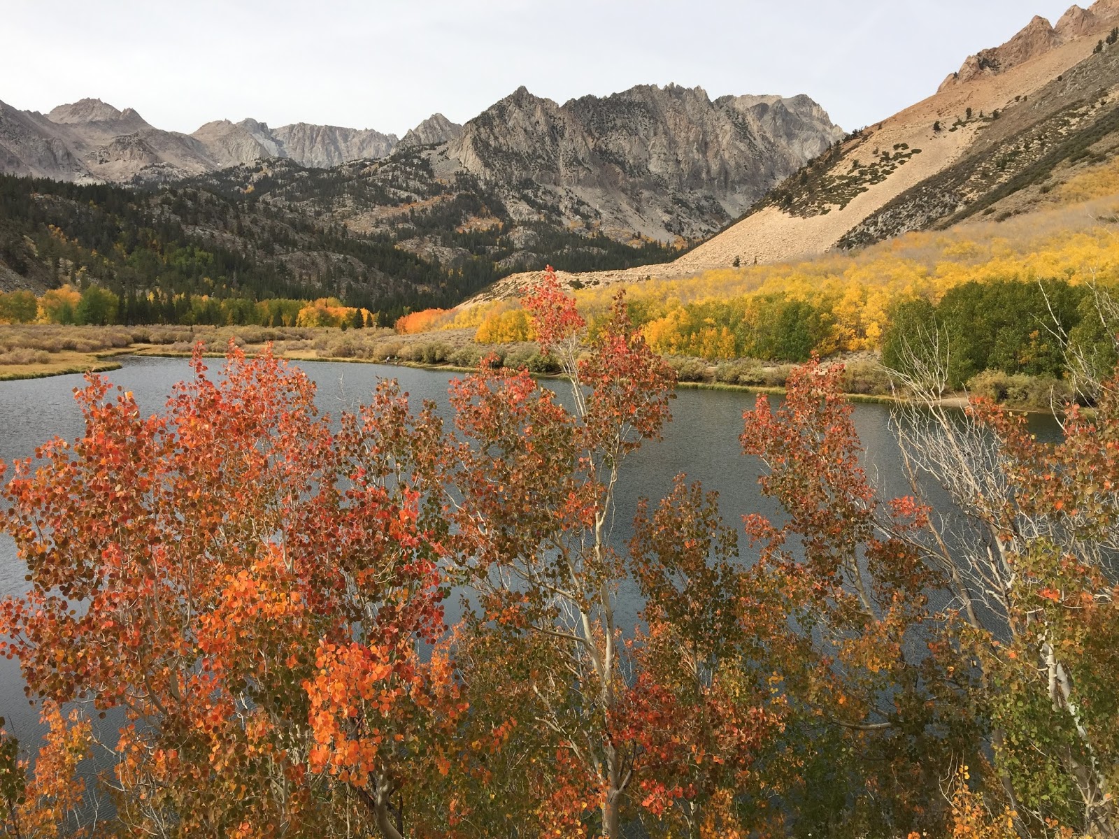
Aspen color on the west side of Lake Sabrina
The roller-coaster that is the divide between Blue Lake and Dingleberry Lake always seems more difficult than it is, but soon enough we are past it and on our way farther up the middle fork of Bishop Creek as it drains four separate glacial cirques from higher in the canyon. The namers of the lakes in this basin obviously had a good time with monikers like: Topsy Turvy, Pee Wee, Hungry Packer, Hell Diver, Bottleneck, and Fishgut. Some of the most impressive mountains on the Sierra Crest stand guardian over these lakes: Clyde Pinacles, Picture Peak, Mt. Darwin, Mt. Wallace, and Mt. Haeckel. It is awe inspiring to visit anywhere in this basin.


Blue Lake with morning shadows


Dingleberry Lake


Dingleberry Lake


Sailor Lake with Picture Peak


Sierra Granite


Moonlight Lake
Moonlight Lake
From the outlet of Moonlight Lake the rest of the route is occasional faint use trail ending in the 500+ foot ascent up a talus and scree slope to the outlet of Echo Lake. This large lake sits at the base of the impressive Clyde Pinnacles and makes a great spot for a late lunch. 

With sunset coming earlier these fall days, we push a little to reverse the route back to the start. We make it with a few minutes to spare, no headlamps needed this day, enjoying the beautiful sunset over Lake Sabrina.


Moonlight Lake from near Echo Lake


Final approach to Echo Lake


Echo Lake


Conglomerate boulder


Moonlight Lake


Moonlight Lake


Sunset over Lake Sabrina

Bird Lists:

Lake Sabrina
Blue Lake
Dingleberry Lake
Topsy-Turvy Lake
Moonlight Lake
Echo Lake

North and Grass Lakes Loop


8 miles

Map track

While Friday was all about big mountains and seeing some fall colors along the way, this hike was all about leaves. This is our favorite exercise hike from Aspendell, one we do all year long including in winter with snowshoes. We get started early again climbing the old trail from Aspendell to North Lake above the Cardinal Mine. From North Lake we ascend the fisherman trail to Grass Lake and return on the Lamarck Lake trail. The birding highlight of the morning is a small flock of noisy Red Crossbills at the Grass and Lamarck Trail intersection. The trees so far this year are an interesting mix, some have already shed leaves completely, others are at peak, while many are still completely green. I suppose the lingering drought has an effect on the trees and how they respond to shorter days and cooler temperatures. Still, a beautiful morning of hiking!


Aspens near the North Lake outlet

Aspens near the North Lake outlet

Along the North Lake road

North Lake and Piute Canyon

Meadow at inlet to North Lake

Along the North Lake Road

Grass Lake

Grass Lake

Piute Crags

Piute Crags

Walking the tunnel of trees on the Lamarck trail

Inlet stream to North Lake

Near the North Lake Pack Station

North Lake

North Lake
Bird Lists:

North Lake
Grass Lake
Lamarck Trail


Tuesday, September 22, 2015

Ruby Mountains

Hike Track

This is a place we have kicked around hiking for years. We've driven by many times, and even day-hiked once in a search for the local specialty bird. We decided that this would be the year and added it as the third hike of our big trip.


The Ruby Mountains lie in northeast Nevada, an isolated range of high peaks (several over 11,000 feet) and deep canyons with extensive glacial evidence. This is also the only North America home for the Himalayan Snowcock, introduced to the area as a game bird between 1965 and 1979. While there are estimated to be less than 500 birds in the wild, they are countable as an ABA bird (added at a time when the ABA committee was obviously much more lenient than they are today). Besides, it would be a lot of fun to see one of these very large grouse if we could manage it.


This trip was planned using the fantastic resources available at  Backpacking in the Ruby Mountains, specifically the Lakes Loop Hike. While the author estimates 19 miles for this loop hike, my GPS measurements were closer to 25 miles. Part of that was likely from wandering from his direct lines in some areas.


Day 1 - Walking with Goats


We arrive at the end of the Lamoille Canyon road around 10:30AM and set off on the short 2-mile formal trail to Island Lake. This is the last trail we will walk on for a couple of days. Island Lake is well known as one of two places easily reached for those trying to add the snowcock to their life list. Most set out in the dark to reach this lake at dawn to listen and scan the cliffs. With our late morning start there is little chance of seeing a bird so we aren't disappointed when the closest we get is finding snowcock poop on the ground as we moved beyond the lake and past the beaten track to the cliffs above. Our route aims for a low point on the ridge to the west of Island Lake reaching 10,800 feet before plunging off the west side. This is our instant introduction to off-trail hiking in the Rubies - if you aren't going straight up, you're going straight down. 


Trailhead parking and route to Island Lake in the mountains on the left


Looking back to trailhead


Island Lake Basin


Cross country above Island Lake. Our goal is the lowest notch in the ridge.


Still a few flowers


And these alpine flowers are tiny


Nearly to the pass


View back to Island Lake from the top


As we stand on top surveying the narrow talus, scree, and dirt choked notch in the cliff face in front of us, I notice a Mountain Goat (also introduced to the Rubies) gently tiptoeing down the slope at the bottom. OK, the goat looks like he's taking it warily down this one, how the hell are us pathetic humans going to pull it off?!! Knowing that our trip route author had survived to write about it, we carefully pick our way down the slope one at a time. 


This is steep!


Look carefully and you'll see Susan in the notch on the right


Look even more carefully and you'll see the Susan dot farther down in the middle


Looking back up to the top.  The 2-D effect of the image doesn't do justice to how steep this was


Traversing above the cliff band before finishing the descent into Thomas Canyon
We reach the bottom of the notch but are at the top of a cliff band that requires a traverse to get around. We finally make it to the bottom of the descent, the head of Thomas Canyon below the imposing Mt. Fitzgerald (11,215 feet), shedding 1,200 feet of elevation. Enough for one day, after staging ourselves on the opposite side of the canyon for the next climb tomorrow, we pitch our tent next to an old beaver pond. We are entertained the rest of the evening by the resident American Dipper, watching him bobbing and picking his way around the edges, sometimes only yards away.


West side of Thomas Canyon


Thomas Canyon


Thomas Canyon


The beaver pond and sunset light on the east slope of Thomas Canyon


Camp in Thomas Canyon
5.5 miles

Bird Lists:


Lamoille Canyon

Island Lake
Thomas Canyon


Day 2 - Yo-Yo Hiking


Ice!
Fall is with us as we awaken to frozen water bottles and ice on the grass in the meadow around the beaver pond. First up today is the climb out of Thomas Canyon followed by a tour of the next canyon west - Right Fork Canyon. This one isn't nearly as difficult as the day before but has plenty of challenges. Where we must cross the ridge is fairly obvious from camp so we start the climb. From camp to the top is about 800 feet, a real alpine feeling as we reach the crest.


Looking back into Thomas Canyon from the ridge. Camp was at the beaver pond in the lower right.


Right Fork Canyon from the top


Right Fork Canyon
We make our way down into Right Fork Canyon, our objective to stay fairly high as we must immediately climb up and out on the far side. At the head of the canyon there is a relatively flat area with trees and water that looks worth a visit. After filling our water bottles we begin climbing again. Within minutes after ascending a short slope I see a large grouse ahead. I immediately think snowcock but quickly come to the realization that it is a Dusky Grouse. This is a species we missed in both the Winds and Sawtooths, so it is a real treat. Susan comes up from behind and I get her on the grouse. We move ahead and several birds flush. This appears to be a family group with mom and 4 young but full grown birds together.  Three have flushed into pines nearby so we get fantastic looks.


Right Fork Canyon


Right Fork Canyon
Up again we go, from 9,600 to 10,200 feet crossing the west side of Right Fork Canyon and into the head of Box Canyon. We could drop down from here but our route author has a side trip in store for this leg of the trip. We will contour from here into a tributary canyon where we climb to an overlook ridge into the Echo Lake drainage. Echo is the largest and deepest lake in the Rubies and should be a worthy destination. The contour line is on the side of a very steep canyon with slippery footing at times. Staying high avoids a significant drop and climb but the tread is ever so slow and tedious. It takes a while with much swearing and finally we are at the overlook. Yes, it was worth the effort.


Leaving Right Fork Canyon


Box Canyon


Contouring


The tributary canyon approach to Echo Lake


Echo Lake
It is afternoon and our feet and legs are beat up from the hiking. We descend down the tributary canyon toward Box Canyon where the next section of route goes. We see plenty of sign that snowcocks live in this area, but none are seen. Coming to a small spring a few hundred feet down slope, and deciding we've had enough for the day, camp is found. In the evening as the sun goes down behind the ridge, a large covey of Chukar perches on the rocks above camp, serenading us with their chuck-chuck babble. It is a great end to the day.


Camp in the canyon
7 miles

Bird Lists:


Right Fork Canyon

Echo Lake


Day 3 -The Voice


I can only describe the call of a snowcock as a cross between the squealing whistle of a bull elk - and the Jetson's spaceship car. They tend to be most vocal right at dawn calling from prominent perches on high cliffs. In the tent with the light hardly bright enough to see 100 yards, and nodding in and out of consciousness, I hear one and he's close. Instantly wide awake I ask Susan if she just heard that. Yes, the call of a snowcock. We jump out of the tent and begin scanning the cliffs above. Nothing. While I get hot water started Susan walks up the ridge a ways searching. Nothing. We know these guys are elusive, but come on! We pack up satisfied with a "close call." 


We are perched high above Box Canyon in the tributary and must descend to the bottom. Our route goes down another impossibly steep slope with much micro route finding necessary to avoid cliffs and talus. At the bottom we find a lovely creek just in time for a long break. 


More steep!

Box Canyon 

A well earned break

We move upstream along the creek for a mile, finding and losing a faint use trail multiple times. Eventually we arrive at the place in the canyon wall we will climb to leave Box Canyon and enter our next objective - Kleckner Creek Canyon. As with all of these canyons, the wall is steep, sometimes obstructed with brush or downed trees. The occasional mixture of use and game trails wander here and there but we find our way to the top of the ridge. Our route author's downloadable GPS track has been invaluable throughout the trip and this section is no exception.

A long down-slope traverse toward Kleckner Creek ends in finally picking up a good trail that takes us up stream to the outlet of Favre Lake and the intersection of the maintained Ruby Crest Trail which will eventually take us back to the trailhead.

 
Moving up Box Canyon. Not much trail here.


Kleckner Creek Canyon from the divide with Box Canyon


Kleckner Creek


Giant cairn shows the way


Go this way!


Kleckner Creek Canyon


Ruby Divide approaching Favre Lake


Favre Lake


Favre Lake from trail above, looking back to Kleckner Creek
While in the high country, Favre Lake is pedestrian with the surrounding views, so we move on. Up, up, up toward Liberty Lake and Liberty Pass on the Ruby Crest. Liberty Lake at over 10,000 feet is much more alpine in look and feel.


Liberty Lake


Liberty Lake and the Ruby Crest


Liberty Lake and the Ruby Crest from near Liberty Pass
Liberty Pass at 10,500 feet is a short distance away so up and over toward the finish. It's late in the afternoon but we have nowhere to be, so decide to pull up at Lamoille Lake for the evening -  only a few miles from the car. This beautiful lake in a glacial cirque is the other regularly checked place for snowcocks so you never know.


Lamoille Canyon from Liberty Pass


Lamoille Lake


Camp at Lamoille Lake


Sunset over the outlet of Lamoille Lake
11 miles

Bird Lists: 

Box Canyon

Kleckner Canyon
Farve Lake


Day 4 - It's a Bird! 

It is dawn again, that first breath of light on a new day. Snug in our bags with no hurry planned for our day we doze. Snowcock!  There are at least two calling from the ridge above camp. I am out first, scanning the cliffs, and Susan quickly follows. It is light enough to see to the top of the cliff 400 feet above, but just barely. We scan and scan with our binoculars, looking for any movement. Finally my gaze makes it to the top of the ridge and I sweep from right to left. There he is on top of a boulder, right at the skyline, head thrown back like a barnyard rooster. Down comes the ethereal call echoing through the canyon. We have our bird.

He is much too far for photos, and straight up a cliff face, so we are satisfied with excellent binocular views that last for several minutes. Eventually he drops off the boulder and quiets, going on with his day as we must with ours. Breakfast is a happy affair and we pack our gear for the last time on this trip. We drop out of the cirque and pass by the diminutive Dollar Lakes before the final miles to the car. It has been a good trip - we've seen some beautiful new country and a very cool bird. What more can you ask?


Sunrise on Lamoille Lake


Dollar Lakes


Dollar Lakes
The final descent to the car with a little of the western forest fires smoke in the air

3 miles

Bird List:


Lamoille and Dollar Lakes