
We have hiked in the Sawtooth Range in central Idaho several times before, but it has been a while. The plan for this trip was to make a grand circuit from the northwest end at the Grandjean Campground and circumnavigate the entire wilderness area in a clockwise direction. After a day off from our Wind River trip for rest and laundry, we were at it again.
Day 1 - The Burn

 |
| Hiking the burn |
 |
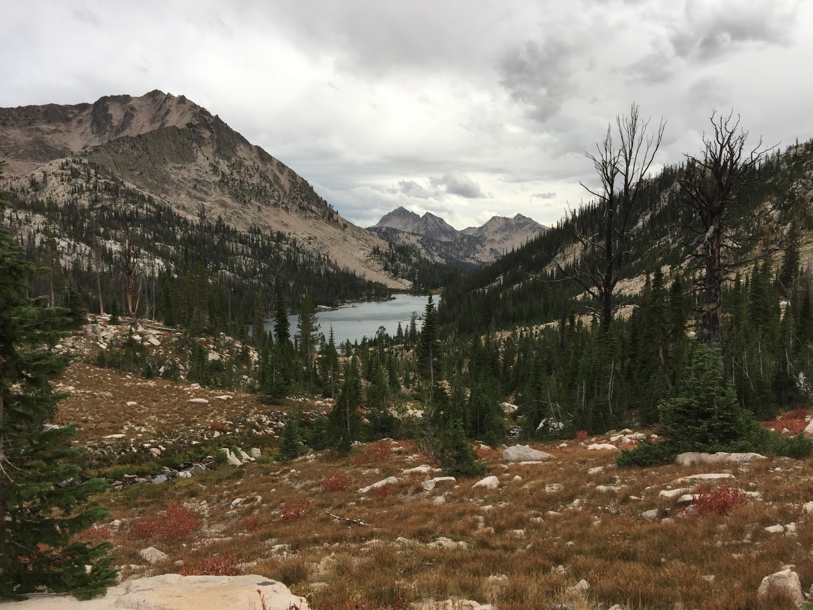
| McGown Lake |
 |
| Crossing the divide |
 |
| Sawtooth Lake |
 |
| Mt. Regan over Sawtooth Lake |
 |
| Sawtooth Lake at sunset |
 |
| Camp |
10 miles
Bird Lists:
Trail Creek
McGown Lakes
Sawtooth Lake
Day 2 - Let's Get Ready to Rumble!
With an early start we moved south past Sawtooth Lake, beyond an inlet tarn through an alpine area, and crossed a low divide into the North Fork of Baron Creek. All that work climbing nearly 4,000 feet the day before was to be mostly given back over the next couple hours.
 |
| Climbing to divide to N. Fork Baron Creek |
 |
| Tarn near inlet to Sawtooth Lake |
 |
| Descending into N Fork Baron Creek |
 |
| N. Fork Baron Creek |
Steadily through the afternoon we climbed Baron Creek back up into the high country, eventually reaching the Baron Lakes Basin at 8,500 feet and our camp for the evening.
 |
| Baron Creek Canyon |
 |
| Baron Creek Falls |
 |
| Approaching Baron Lakes Basin |
 |
| Baron Creek |
 |
| Lower Baron Lake |
 |
| Lower Baron Lake |
 |
| Lower Baron Lake |
 |
| Camp at Lower Baron Lake |
Bird Lists:
North Fork Baron Creek
Baron Creek
Baron Lakes
Day 3 - Hiking on the Moon
Another big day with big miles through the heart of the Sawtooth high country. We left camp and quickly reached the upper Baron Lake just a short distance up canyon before the final climb to Baron Pass at 9,200 feet.
 |
| Lower Barron Lake in the morning |
 |
| Looking back at Lower Baron Lake |
 |
| Upper Baron Lake |
 |
| Baron Lakes from Baron pass |
 |
| Redfish Lake Creek Canyon |
 |
| Descending into the canyon |
 |
| Redfish Lake Creek |
 |
| Redfish Lake Creek |
 |
| Lower Cramer Lake |
 |
| Middle Cramer Lake |
 |
| Climing to the divide |
 |
| Tarn above Cramer Lakes on the way to the divide |
 |
| The last of the flowers |
 |
| Walking on the moon near the divide |
 |
| Mt. Cramer and the divide |
 |
| Tarn above Hidden Lake from the pass |
 |
| Hidden Lake |
 |
| View across Hidden Lake from camp |
 |
| Camp at Hidden Lake |
 |
| Hidden Lake |
17 miles
Bird Lists:
Baron Pass
Redfish Lake Creek
Cramer Lakes
Hidden Lake
Day 4 - SNOW!
Imagine it is 3AM, pitch black dark -
Susan, in a panic: The tent is on me!
Bob, half asleep: I told you not to lean your pack against the tent pole.
Susan, more than a little agitated: No, you're not listening, THE TENT IS ON ME!!
Bob: What the f%&*!!
The are POUNDS of snow on the roof of the tent and one of the support line stakes has pulled out of the ground, all collapsing the roof of the shelter directly on top of Susan. We manage to push the wad of heavy snow off her and I get out the door to put everything back in order. There are inches of snow on the ground, that wet slushy stuff that falls when the temperature is hovering right above the freezing mark. The "snowflakes" coming down are the size of a silver dollar, splatting everywhere. Shelter back in working order we settle back in to ride out the rest of the night. From inside we can hear the big flakes splat on the roof. We quickly realize that when you can't hear them splat anymore the buildup is getting heavy and someone needs to bang the roof from the inside and knock it off. This goes on for hours, banging the shelter roof every 30 minutes to cause another inch of slush to avalanche down the sides. By daylight there is a nearly foot tall pile of snow at the corners of the tent where the slush slides off to rest. Finally around 9AM it stops so we can get out and assess the situation.
 |
| Hidden Lake in the morning |
 |
| Our poor little shelter |
 |
| Christmas on Labor Day weekend! |
Disappointed but making the right call, we decide to bail out.
It takes a long while to get everything packed up. First I had to find everything I had foolishly left lying about camp that is now buried under the snow. That done we pack up the last of the wet stuff and set off. The precipitation has fallen so quickly and in sufficient quantity to flood the trails with water and melting slush. Keeping our feet dry is out of the question, and it is cold!
 |
| Heading out |
 |
| Cold, wet feet |
 |
| But it sure is pretty... |
Dropping down canyon into the South Fork Payette River canyon we find the last of the snow at 7,000 feet. After that it is just wet and flooded from rain - lots of rain. And to add insult to injury, the trail crosses numerous rain swollen side creeks and the Payetter River no less than 7 times as we walk down canyon! Wet feet were the order of the day.
 |
| Fall leaves |
 |
| No shortage of water crossings |
 |
| Crossing the Payette River |
 |
| Moving down canyon |
 |
| Ferns! |
 |
| Jefferey Pine |
21 miles
Bird Lists:
Upper South Fork Payette River
Lower South Fork Payette River
No comments:
Post a Comment