Saturday, August 31, 2019

Northern Yosemite Backpacking

Hike track link

Time to strap on the backpacks and go adventuring. Susan plotted this route on a map and we executed it perfectly. It was about 50% each on and off trail in Northern Yosemite. Friend Brian came along for the entire trip, and Hikin' Bill joined us for part of the first day.


Our departure trailhead was at the end of the Virginia Lakes Road north of Mono Lake. A reasonable but long climb got us to the top of Burro Pass and gave us many incredible views.


Blue Lake


Blue Lake


An old "Fixer Upper" cabin on the climb to Burro Pass


Cooney Lake


One of the Frog Lakes


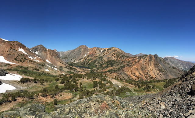
Looking back to Virginia Lakes trailhead from Burro Pass


Summit Lake below Burro Pass

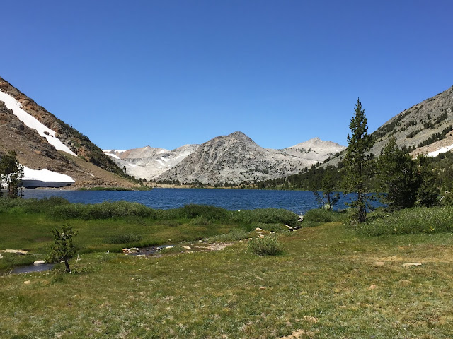
From there we were headed downhill to the true Sierra pass (east/west divide) at the outlet of Summit Lake. It's very strange topography here.  Summit Lake made for a nice lunch stop and turn-around point for Bill.

 
Descending from Burro Pass
Still plenty of snow in the high country
Hoover Lakes from near Burro Pass
Summit Lake

Mariposa Lilies


Summit Lake
From Summit Lake we descended into Virginia Canyon. Looking at the map we didn't think there was enough daylight to make it anywhere significant, so decided to call it quits early at a nice campsite along Reverse Creek.


Gray Butte


View from camp in Virginia Canyon
Sunset light


Reverse Creek

The next morning had us continuing down canyon in the trees before turning south and up-slope on the PCT for a mile, and then turning and ascending to Lower McCabe Lake. The McCabe Lakes basin is off the beaten path for most hikers, and in fact we saw hardly anyone for the next couple days. The three McCabe Lakes sit in a glacial carved basin directly below the incredible Shepard Crest just north of Mt. Conness. We've been eyeing this spot for many years on the maps, and finally made it. After a leisurely lunch at Lower McCabe we climbed cross-country up a ridge with amazing views to Upper McCabe Lake for the evening.


Lower McCabe Lake


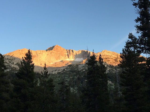
Shepard Crest

Virginia Canyon below


Looking northwest from near outlet of Upper McCabe Lake


Upper McCabe Lake
Home for the evening


Shepard Crest and Upper McCabe Lake

Shepard Crest in sunset light
Sunset on Upper McCabe


Shepard Crest and Upper McCabe Lake


Day three had us hiking the trickiest part of the route - a cross-country scramble over "Don't be a Smart Pass" separating upper McCabe Lake and Roosevelt Lake. I had scouted it the evening before, and while the center was full of snow, the edge was passable on loose scree and talus. This direct route to Roosevelt saved us many miles over going around the long way and got us to Susan's most wanted location for the trip.


Upper McCabe from the inlet end


Looking up at "Don't be a Smart Pass"


A shot of the pass I took the afternoon before on a scouting mission


Climbing the scree and talus to the pass


Almost to the pass


Pushing up the last scramble to the pass

The views from the pass were amazing in both directions. And a short contour to the west at the level of the pass brought us to another notch in the mountains with even more spectacular views. We spent the better part of two hours up there enjoying the grandeur. Then it was time for the gentle descent to Roosevelt Lake.


Roosevelt Lake far below, from the pass


Middle and Lower McCabe Lakes
Roosevelt Lake and Sheep Peak


Roosevelt Lake from partway down the pass


A few words about Roosevelt Lake are in order. FDR announced that 1934 was National Park Year. Eleanor and her friend, Lorena Hickok, horse packed into Lower Young Lake and spent four days exploring the surrounding area with the help of a five rangers, seven horses and five mules. During that stay Eleanor fished in Young Lake and helped stock trout into Roosevelt Lake. At the time the lake was unnamed, but after the trip was named for her. Today the NPS is trying to eliminate all the fish from Roosevelt Lake and return it to the Yosemite Toad and Yellow-legged Frog, both of which are endangered due to the introduced fish.  As we walked along the lake shore we saw several ropes going into the water with floats attached.  They were some sort of experimental gill net, let's hope they work.


The lower part of the pass we descended to Roosevelt Lake


Mt Conness and Roosevelt Lake panorama


Roosevelt Lake


Roosevelt Lake looking back toward pass
From the outlet of Roosevelt Lake we did our best to cross-county (through great flowers!) and contour the elevation across the head of a valley to Young Lakes, our final overnight destination for the trip.


Outlet of Roosevelt Lake
Meadow below Roosevelt Lake

Mt Conness


Lupines and Mt Conness


View across valley back towards Roosevelt Lake


Spectacular Paintbrush at Upper Young Lake


Upper Young Lake


Upper Young Lake


Outlet of Upper Young Lake


Our exit day took us from Upper Young down to the two lower Young lakes, across through Dingley and Delaney Creeks, to Dog Lake and Lembert Dome. A few last magnificent views along the way brought our fantastic trek to a close.

Lower Young Lake and Ragged Peak


Lower Young Lake and Ragged Peak


Ragged Peak


A great view from near Dingley Creek


Lembert Dome

2 comments:

  1. Absolutely fabulous photos! Thank you so much for sharing. Janet

    ReplyDelete
  2. Thanks. Only wish I could have done it.

    ReplyDelete