Friday, February 19, 2016

Andrews Mountain


Bird List


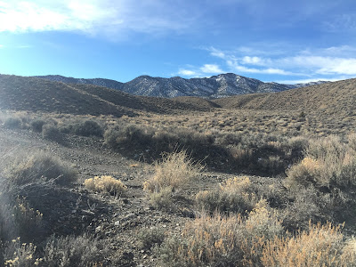
Snow covered Andrews mountain in the distance
Once more into the Inyo mountains for some hiking. While snowshoeing is fun, it is difficult to keep in PCT trail shape unless we get in enough dirt hiking miles. With all the recent snow we wanted to find an interesting hike at lower elevation. After two successful and enjoyable hikes in the Inyo's in recent weeks, we decided to try again. This time our objective was to hike south from the Death Valley road out of Big Pine, toward Andrews Mountain, until we got a feel for the snow at higher elevations. From the maps we saw the possibility of connecting two jeep roads, with some cross country, creating a big loop - if the snow would let us. We started the loop clockwise, which would later become evident as a very lucky and wise choice.

We started off generally southwest on the Squaw Flat jeep road, entering an interesting canyon with pinyon and juniper. Right away we started seeing birds, with a nice sized group of Pinon Jays and a pair of Juniper Titmice. Steadily climbing we eventually reached the ridge line that forms the east shoulder of Andrews Mountain. The snow looked heavy on the north side of Andrews so we circled to the south side, dropping into a lovely sagebrush meadow.


Excellent views of the Sierra crest almost immediately
Pinyon Pine roots exposed by erosion
Hiking up canyon toward the ridge
Sierra Crest across the Owens Valley from the ridge
North view with White Mountain on the left horizon
Old mine entrances
Hiking across the sagebrush meadow
Southeast side of Andrews Mountain is mostly snow free
The sagebrush meadow with Andrews Mountain
We worked our way west across the sagebrush meadow and found Andrews Mountain to be virtually snow free from this approach. To the top! This approach was steep, with plenty of talus to keep it very interesting. It was worth the effort, lunch views from the top were outstanding! The best "wildlife" sighting from the summit was the ladybugs - there were hundreds, if not thousands! They were very active on this beautiful spring-like day. Apparently the top of mountains is where some of these beetles go to hang out in winter. Who knew? 


Talus approach
Hikin' Bill puttin' in the effort!
Talus slogging
East from the top toward Death Valley and Nevada. The sagebrush meadow we came up from is in the center.
View west to the Sierra Crest
Northwest to the Owens Valley and beyond
Thanks to Hikin' Bill for grabbing the summit snapshot
Susan admiring the view
West panorama
Survey marker on the summit
Squaw and Waucoba Peaks to the southeast
Overwintering Ladybugs
There were hundreds of Ladybugs out on this fine day
They were litteraly everywhere we looked!
Evidence of human activity on the summit, but extensive internet searching didn't turn up a reason.  


Andrews Mountain from the west side descent
After lunch we continued down the west shoulder of the slope, connecting with an old mining road that would lead us to our car. Once on the true north side of the mountain we found the snow - and lots of it. We had to slog through deep accumulation and drifts, often up to two plus feet in the very shaded areas. Luckily it was down hill and only caused some aggravation and very wet feet. We were so happy to NOT have climbed that slope in the snow. An hour or so later we were below snow line and hammered out the last few miles to the car. We saw many more groups of Pinyon Jay as we descended, including one flock of well over 100. We eBirded 230 for the day, but that was likely a conservative low number. They were everywhere! Overall it was an extremely enjoyable day, with outstanding views throughout. 


Snow slogging


1 comment:

  1. You two are amazing. So many great photos of places that I will never see. Thanks so much.

    ReplyDelete