 |
| View of Olanch Peak from Sage Flat |
In mid-May we found a slight gap in the windy weather and decided to bag a peak we'd been eyeing for many years. Olancha Peak is the first 12,000 foot plus peak in the Sierra as you move from south to north. Our trip was made possible this early in the year only by the dismal snowpack in the mountains. The lack of snow also made for slim pickings on water sources as well, but we found a location of a small spring that should still be running.
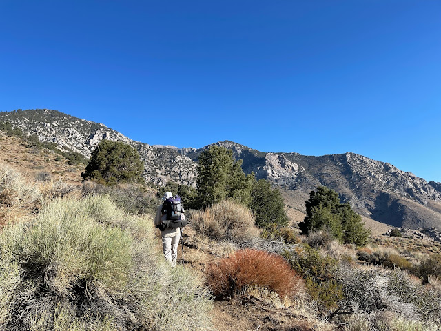
There is no close trailhead approach to Olancha, with the traditional route going up from Sage Flat in a 22 mile round trip with over 6,000 feet of elevation gain. We decided to backpack it over several days and take it easier. We made 7 miles the first day, with over 4,000 feet of elevation gain to a nice campsite in the Jeffrey Pines. The spring was running with a trickle of water, so we were all set. We had some good birds on the way up including several Sooty Grouse, some of the farthest south population in Inyo County.
eBird list
 |
| View back down the the valley from near our campsite. Owens Lake on the distant left |
 |
| Haiwee Reservoir in the valley below |
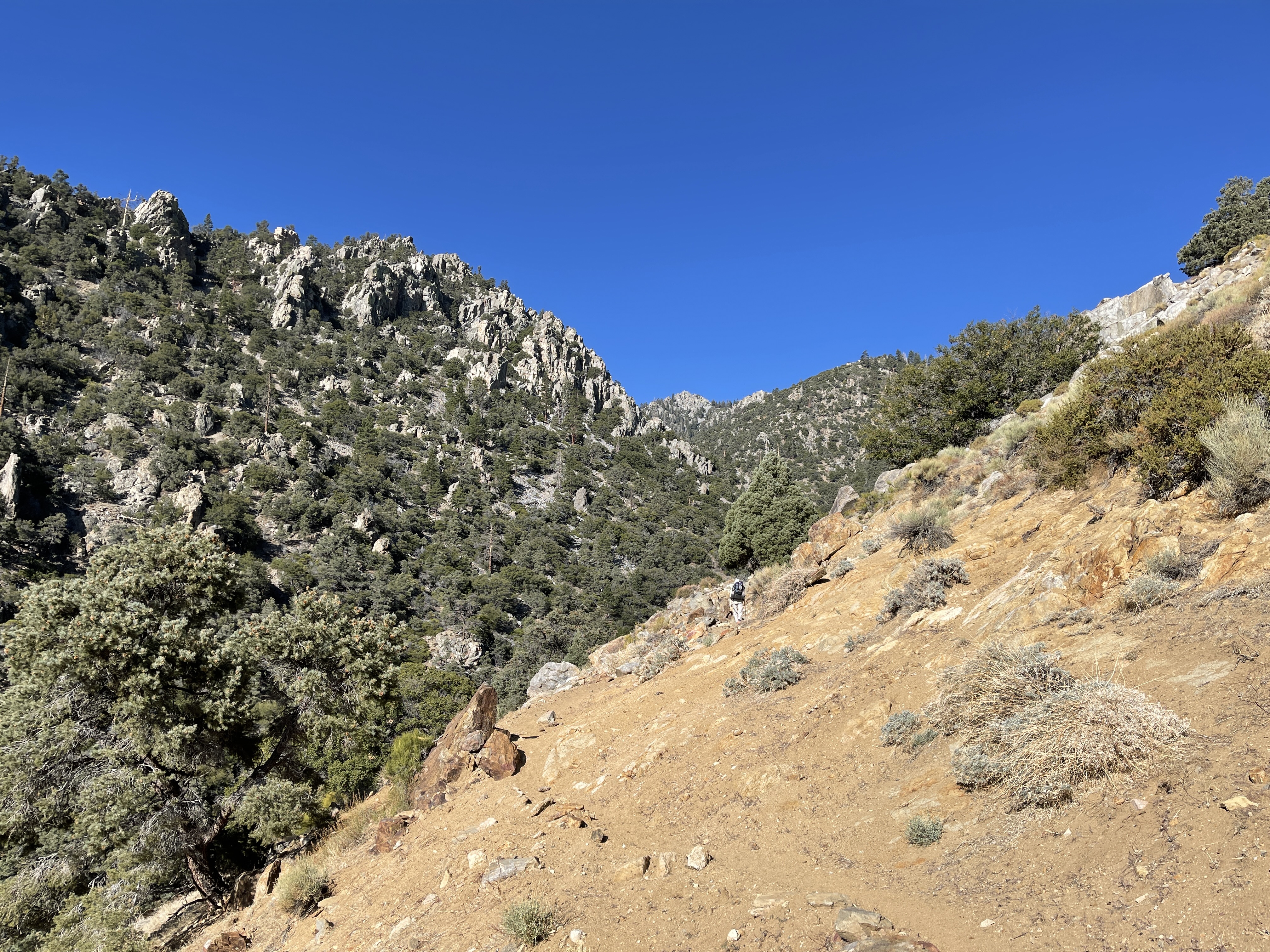
We got an early start the following morning for an expected 7'ish mile ascent to the summit. The first few miles are all on trail, or easy bush-whacking, with the final half a mile and 1,600 feet of gain being all cross-country on talus and steep mountainside. We knew for the final approach to the summit we had to stay well north of the summit block, or be prepared for some unpleasant rock scrambling. Looking at the map I thought we were far enough north, but we still ended up with about 50 feet of vertical climbing in a series of small notches that Susan didn't enjoy one bit. But we made it without too much trouble so all was well. The forecast wind hadn't picked up yet as we enjoyed the 360 degree views from the top, so lunch was very pleasant. We veered farther north on the descent route, adding another quarter mile to the route, but avoided the nasty summit blocks.
 |
| Starting the final scramble to the top |
 |
| Susan wasn't very happy about this required spiderman move |
 |
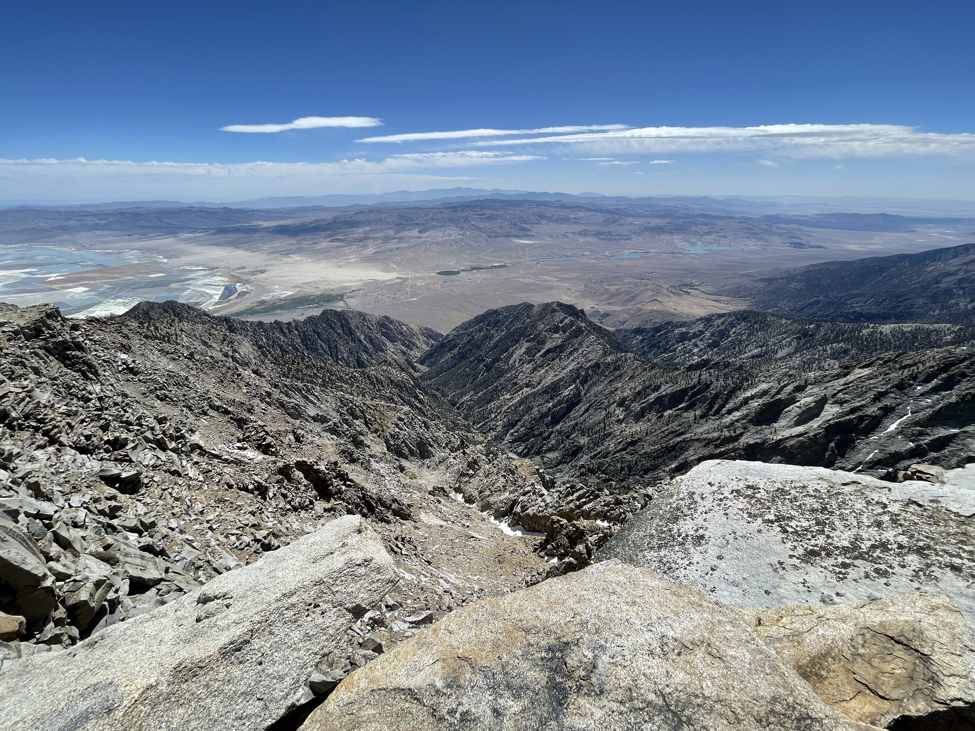
Mt Whitney and Mt Langley in the middle distance, both
over14,000 feet elevation. Note the lack of snow in mid-May. |
 |
| Summit register box |
 |
| USGS summit marker |
 |
| The Owens Valley from the summit |
 |
| View to the southwest of the Kern Plateau and Domeland Wilderness |
 |
| The Great Wester Divide in the distance |
 |
| Closeup of Mt Whitney and Mt Langley |
We made it back to camp for a fun evening of howling wind. Our protected campsite kept us sheltered so we made the best of it. The wind died down just enough by morning to make for an enjoyable trek back to the trailhead with lots of good birding along the way.
eBird list
 |
| Kern frasera - a gentian that normally blooms in July and August |


4,000 ft elevation gain on day one. A 50 ft nearly vertical climb to the summit. I'm not tagging along with y'all! Way to go, Susan! You beat your fears. I would have been left below, crying like a little baby.
ReplyDelete